
Sentinel-2 Super Resolution


Try it now:
ESA Copernicus Sentinel-2 images with Super-Resolution for damage assessment and nature resources monitoring toolchain. Unbelievable quality improvement from 10 m/pixel to 1 m/pixel you can try it by your self in our demo area.
Sentinel-2 (S2) is an Earth observation mission from the Copernicus Programme from ESA that acquires optical imagery at high spatial (maximum 10 m) and temporal resolution (5 days revisit time at the equator) over land and coastal waters. The S2 multispectral instrument (MSI) includes 13 bands, which are captured at different spatial resolutions.
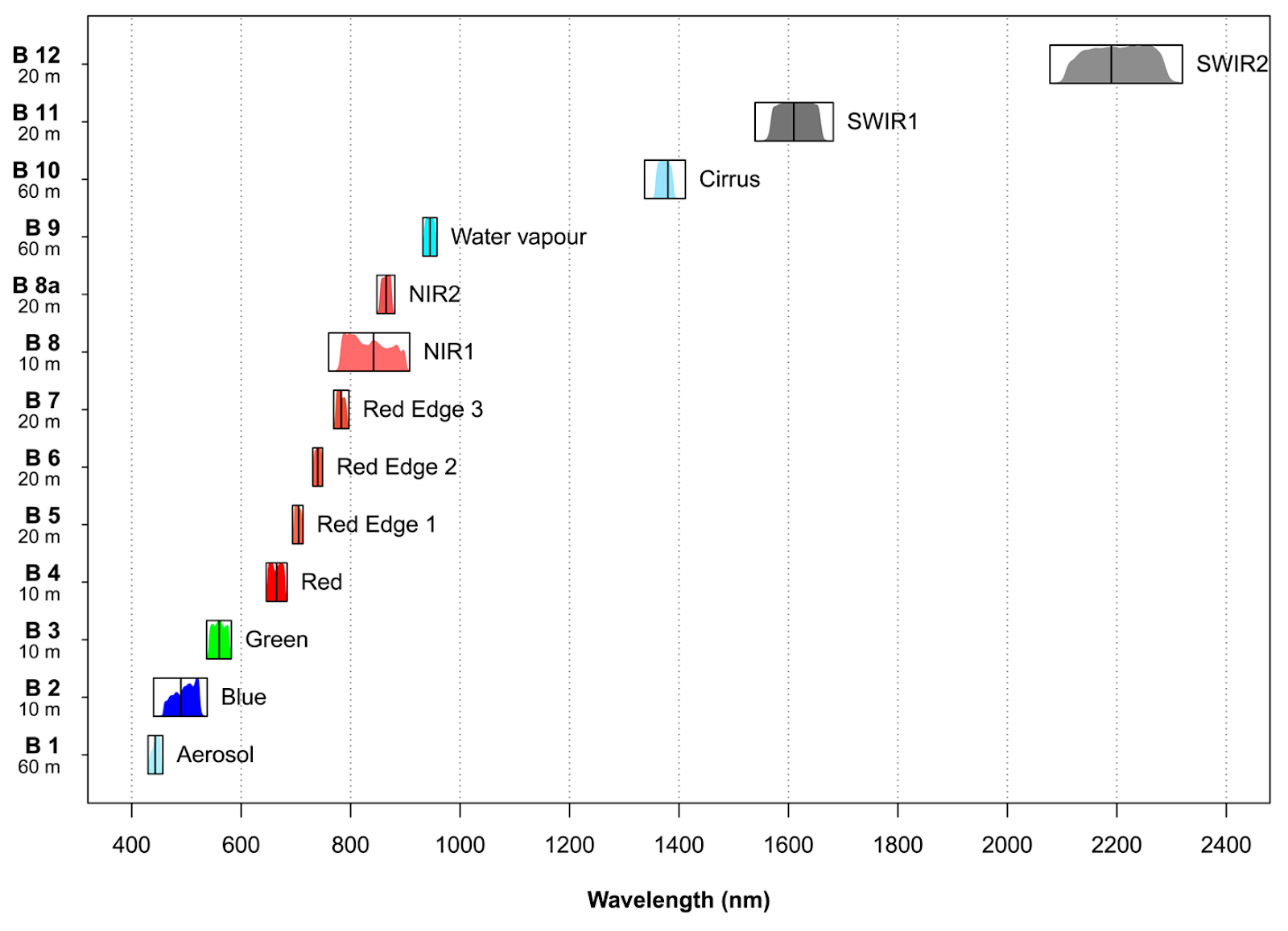 Figure: Characteristics of the multispectral instrument (MSI) on board Sentinel-2
S2 Super-resolution creates a 10 m resolution band for all the existing spectral bands with 20 m and 60 m using a trained convolutional neural network. This processing block’s output is then a multispectral (12 band), 10 m resolution GeoTIFF file. The first band (B1) is discarded since it’s only useful for atmospheric correction. This is especially useful for achieving a high degree of detail with analysis in the lower resolution bands. For instance, computing a water index like NDWI (Normalized Difference Water Index) requires band 8 (NIR) and band 12 (SWIR2), which are in different resolutions (10 m and 60 m, respectively). Using the output of S2 Super-resolution, we get a 10 m NDWI product.


There are no reviews yet.